Atlas de Campamentos en riesgo en Chile
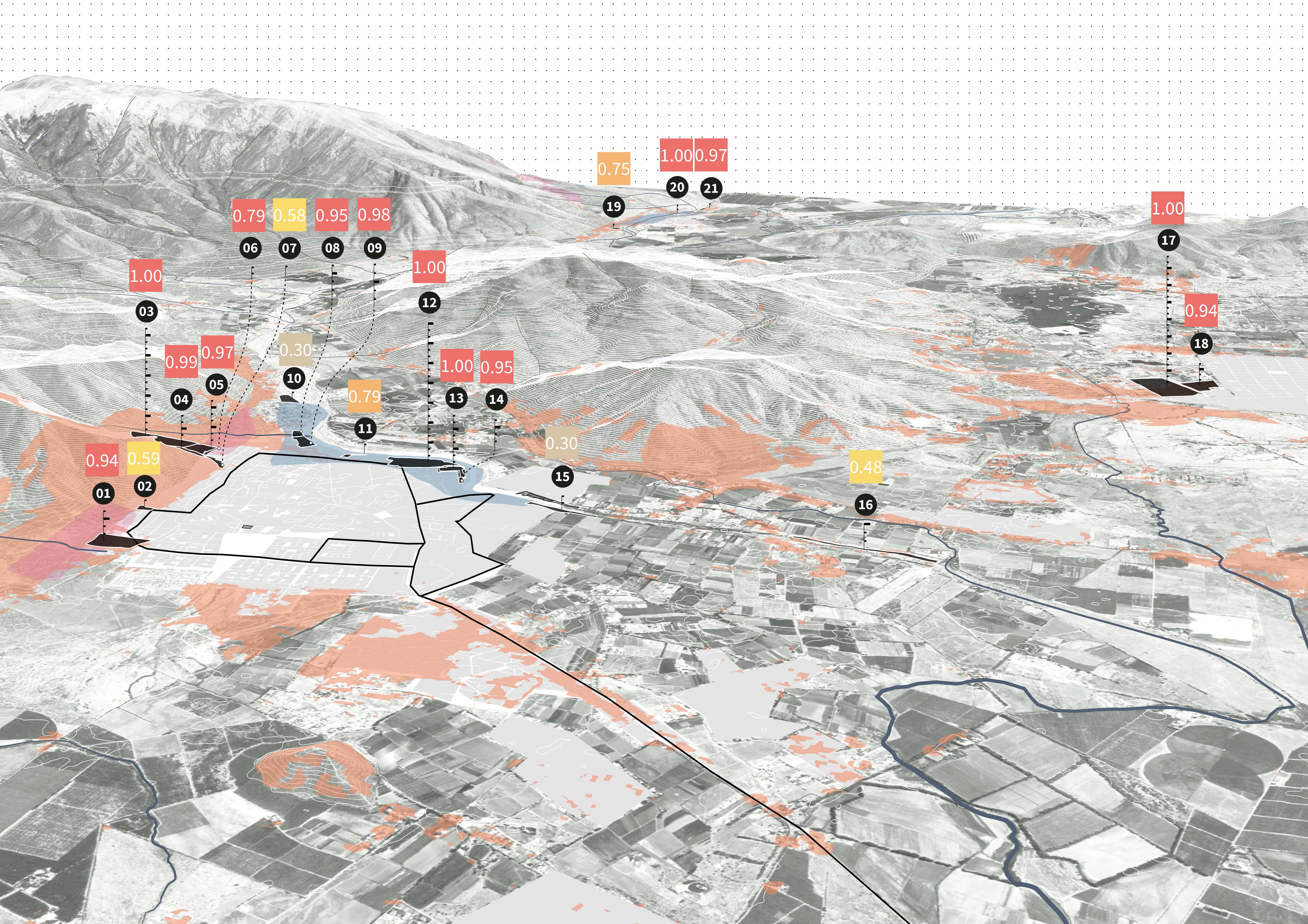
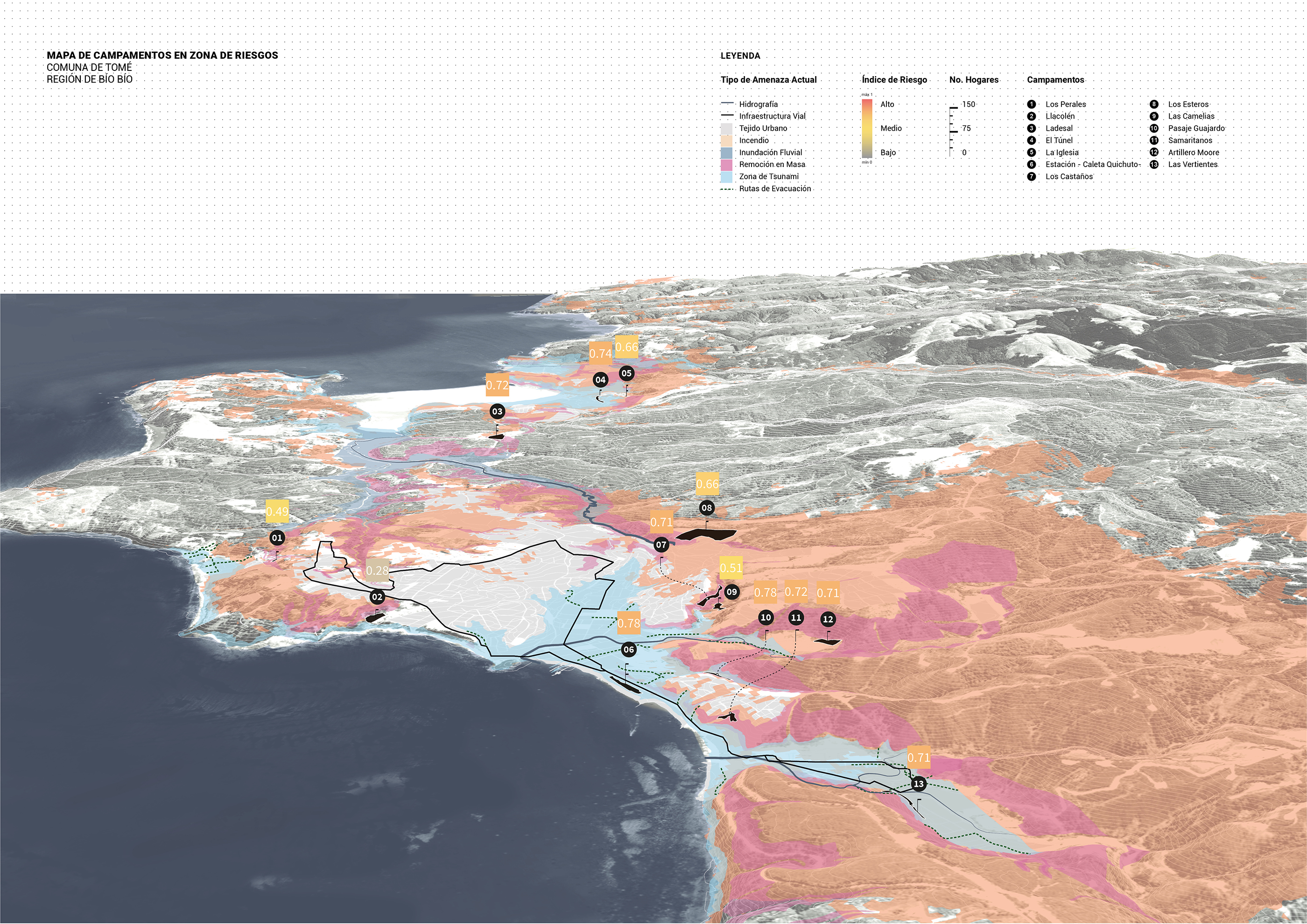
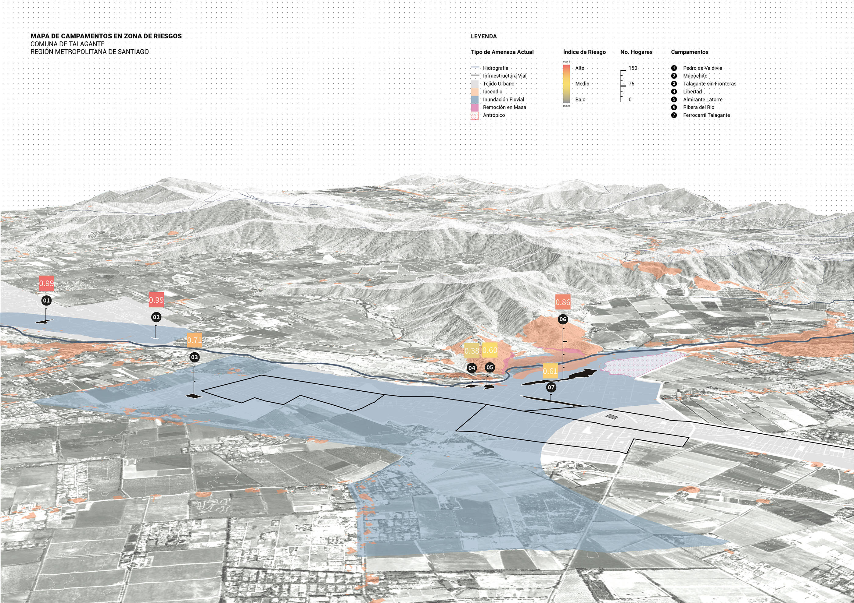
The Atlas of informal settlements is developed in collaboration with MINVU and IADB. It intendes to visualize the risks that informal settlements face in Chile, to prioritize interventions for adequate decision-making.
AA GroundLab and Inter-American development Bank.José Alfredo Ramirez, Clara Oloriz, Daniel Kiss, Iulia Stefan, Carlotta Olivari, Elena Luciano Suestagui.
Chile.
2022
Data managment, cartographic visualisation.
The Atlas of informal settlements is based on 2021 census: a total of 1114 campamentos are counted, of which 722 are in a risk area. A methodology was developed to calculate a risk index integrating various risks and datasets for policy and decision making.
For the purpose of this atlas, 40 cartographies of selected comunas have been, highlighting the physical and geographical features, the informal settlements geolocation and spatial conditions as well as their associated risks. The risks represented include landslides, fires, anthropic, riverine and coastal flooding and earthquake evacuation routes.
Location: Chile
Year: 2022
Design Stages:Data managment, cartographic visualisation.
Full description: Atlas developed in collaboration with MINVU and IADB visualising the risks that informal settlements face in Chile. A methodology was developed to calculate a risk index integrating various risks and datasets for policy and decision making. It includes 3d visualisations in selected towns across the Chilean regions highlighting the physical and geographical features, the informal settlements geolocation and spatial conditions as well as their associated risks. The risks represented include landslides, fires, anthropic, riverine and coastal flooding and earthquake evacuation routes.


