Rewild the productive landscape The research project has been developed at the AA Landscape Urbanism programme. The research aims to re-establish a reciprocal relationship between human and non-human processes in alternative productive landscapes based on agroecological schemes.
Carlotta Olivari,
Zhuqing Li,
Yuanyuan Huang.
United Kingdom.
2021
Research, data managment, cartographic and 3d visualisation.
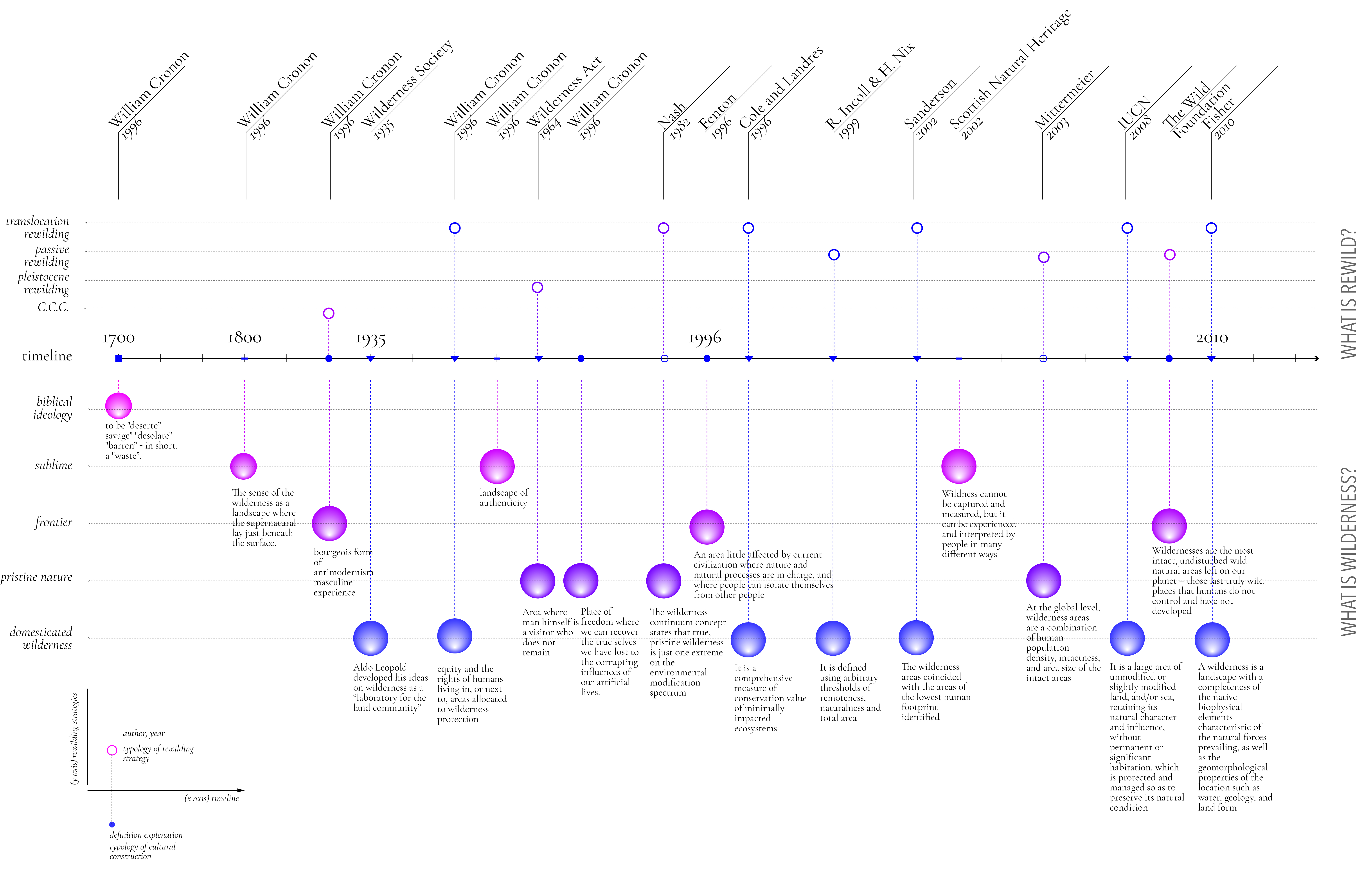
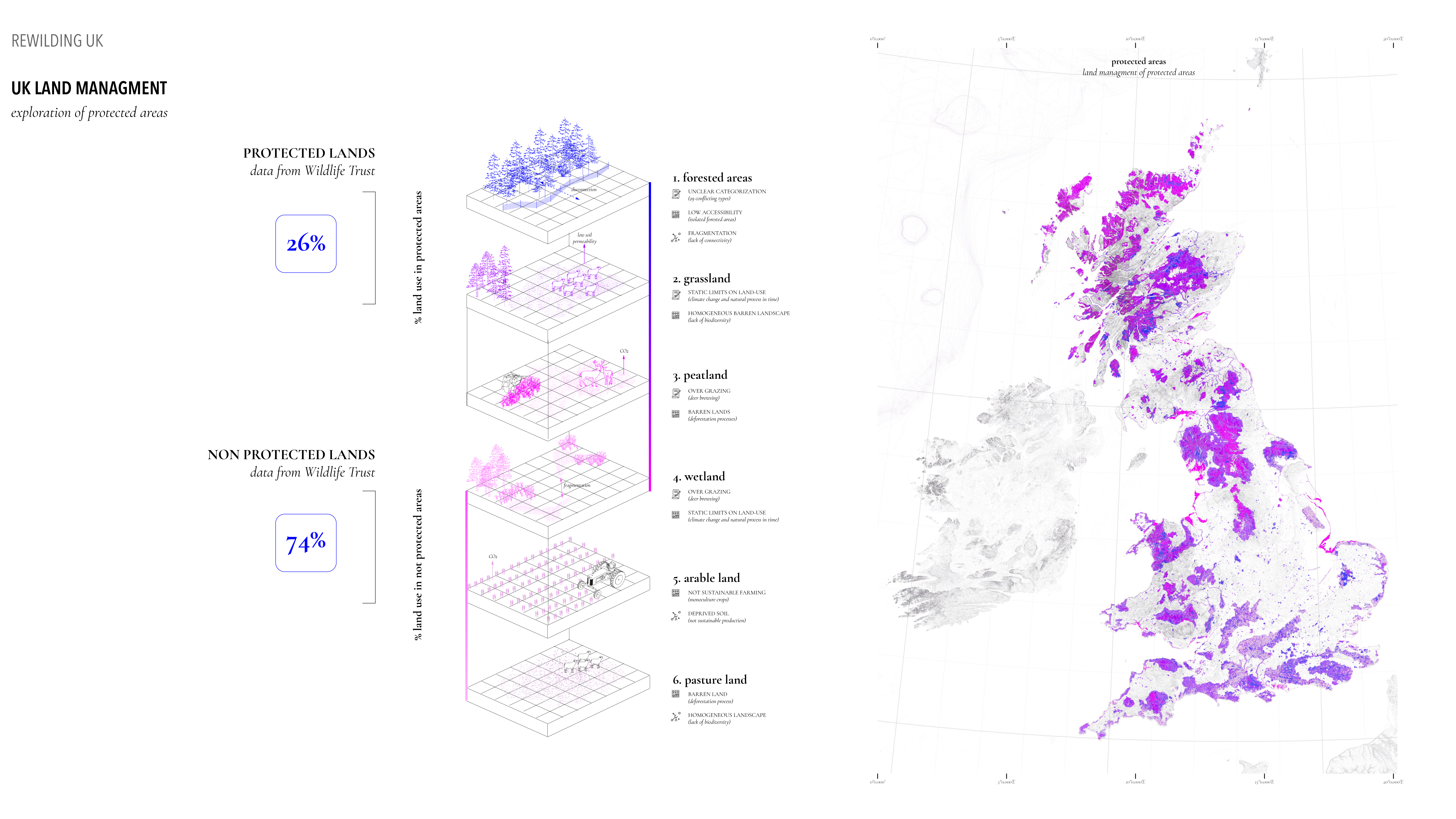
How to design an integrated strategy to rewild the agricultural land in a just way? Rewilding UK thesis introduces the issue of the current UK’s land management and environmental crisis, trying to use the concept of rewilding to respond to these issues. The ongoing rewilding projects are prioritizing small wild areas creation over systematic and connective transitions at a large scale. Based on the existing literature and practices, the thesis proposes a new definition of rewilding. Through a gradient of rewilding actions, the aim is to re-establish a reciprocal relationship between human and non-human processes in alternative productive landscape.
Location: United Kingdom
Year: 2021
Design Stages:aResearch, data managment, cartographic visualisation, design strategy.
Full description: Atlas developed in collaboration with MINVU and IADB visualising the risks that informal settlements face in Chile. A methodology was developed to calculate a risk index integrating various risks and datasets for policy and decision making. It includes 3d visualisations in selected towns across the Chilean regions highlighting the physical and geographical features, the informal settlements geolocation and spatial conditions as well as their associated risks. The risks represented include landslides, fires, anthropic, riverine and coastal flooding and earthquake evacuation routes.


